Oman is simply made for off road adventuring. There are endless tracks through deserts, wadis, mountains and coastal plains. You can plan an almost limitless range of routes, but this is a quick round up of those I think are the best of the best.
I have tried to choose a real range of Oman’s off road routes so that there is – hopefully! – something for everyone. Some of the itineraries described below are very easy, and only really just edge into the “off road” category because short sections are unpaved. But others are very serious undertakings, requiring considerable navigation and driving skill. Be honest with yourself about your confidence and skill level, and pick the route you will enjoy the most by having a safe trip.
NAVIGATING OFF ROAD IN OMAN
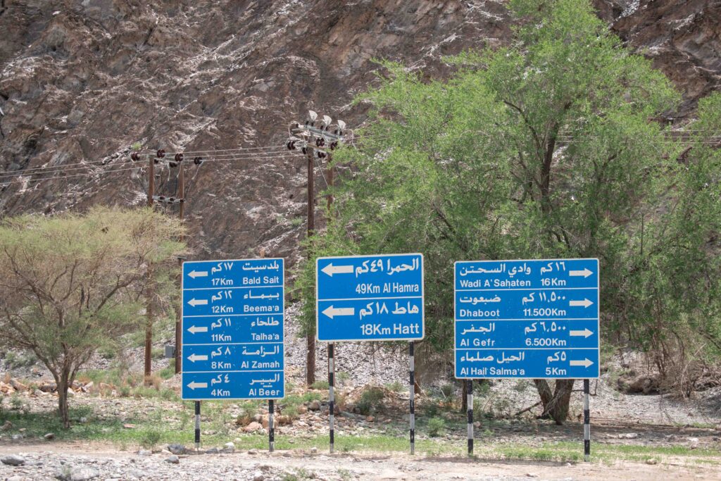
Paper maps are not common in Oman, and you will struggle to find a detailed road atlas akin to those you might be used to in the UK or Europe. Waze and Google Maps work extensively, although avoid relying entirely on them in more remote areas. You can pick up an e-SIM on arrival at the airport in the arrivals lobby. Ooredoo currently offer 8GB SIM for 5 OMR (about £11).
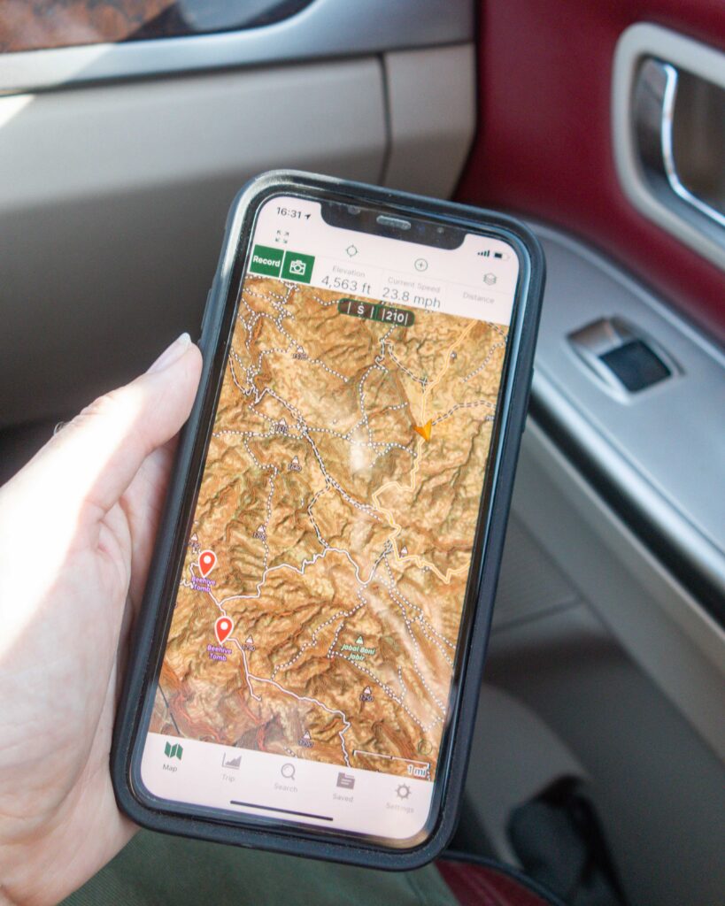
For more adventurous trips, we use the excellent Gaia GPS navigator app. It is particularly good for following tracks when you don’t have internet as routes can be downloaded in advance. The route maps below are displayed in Gaia.
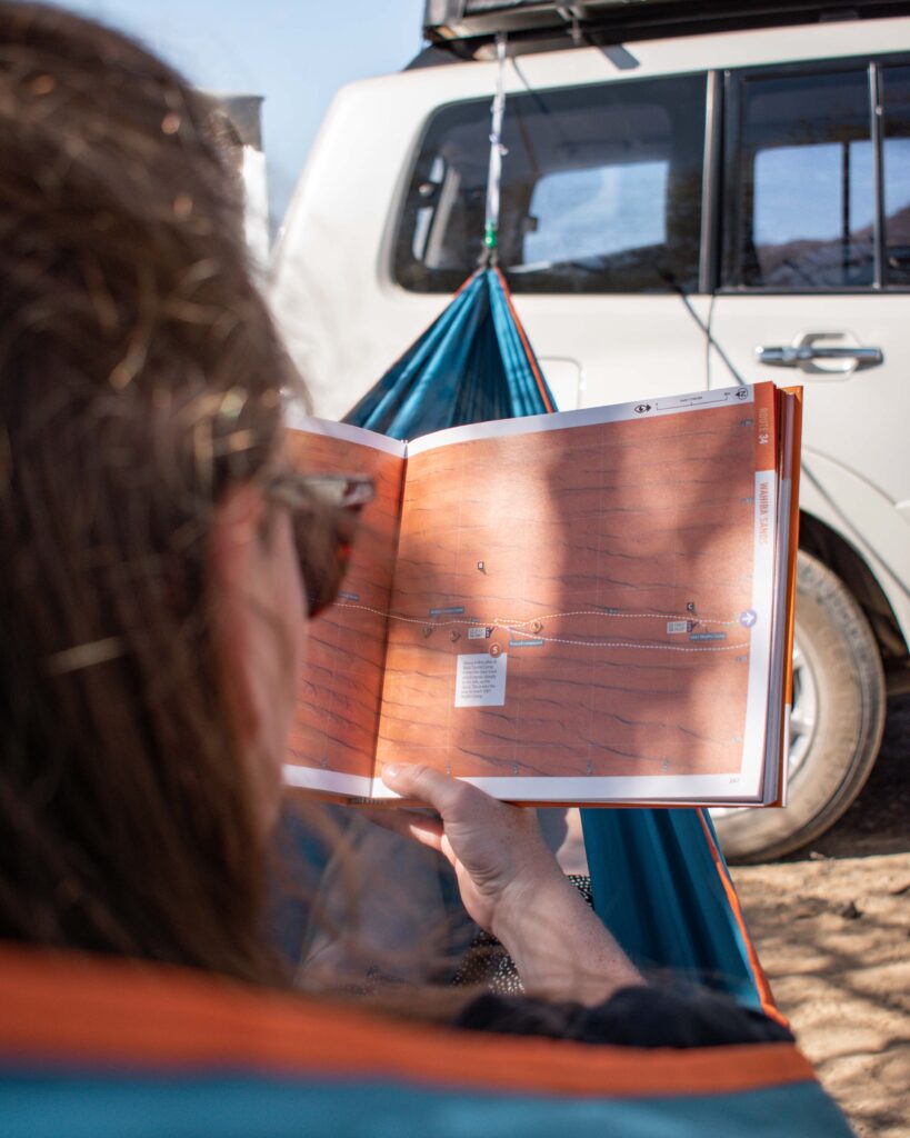
If you want some help designing your routes, the excellent Oman Off-Road guidebook sets out a series of drives and hikes across Oman, all with suggested camping spots. Unfortunately, for some reason it is often hard to get hold of in advance. But it is nearly always stocked in the bookshop in Muscat Airport, Spinney’s at the Wave/Al Mouj and sometimes the Al Fair supermarkets.
On a related note, finding hiking routes can be similarly tricky. The PDF routes available online from the Omani Ministry of Tourism are no longer updated, so the Trekking Oman website is usually the best resource to use.
ROAD CONDITIONS
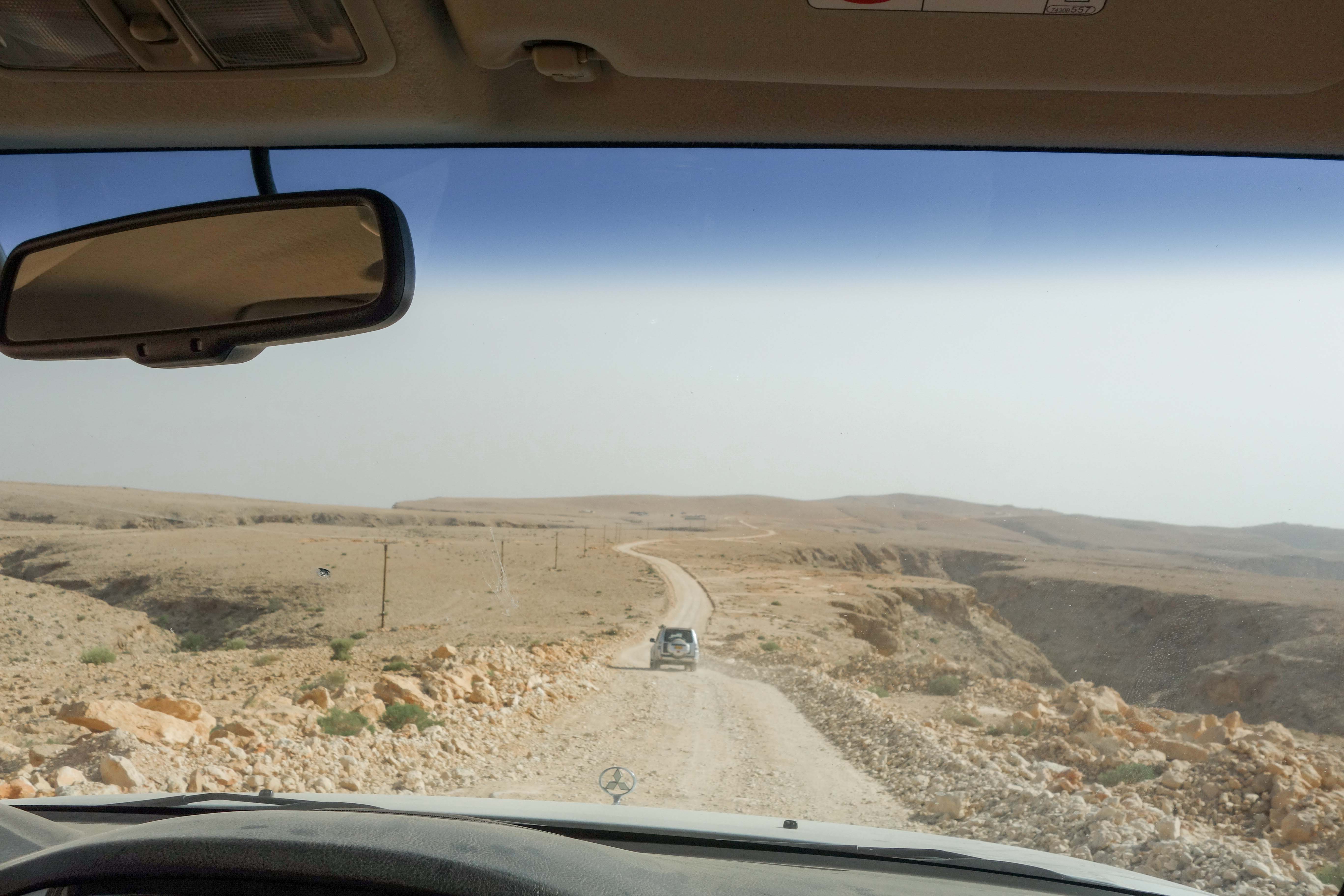
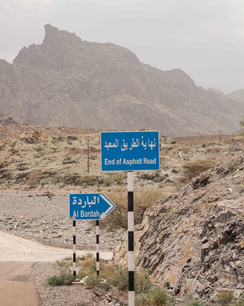
Whilst I have tried to provide detailed route descriptions and GPS coordinates to allow you to explore these off road adventures yourself, the directions described below are only accurate up to a certain point. As many of these routes are in part, or wholly, on dirt roads, graded roads and unpaved tracks, they are subject to change. For example, the first time we went up the Salma Plateau, flooding in the preceding weeks meant that sections of the route described in the Off Road guidebook were unpassable. So be prepared to change your plans, and have the equipment and confidence to allow you to navigate a new route independently.
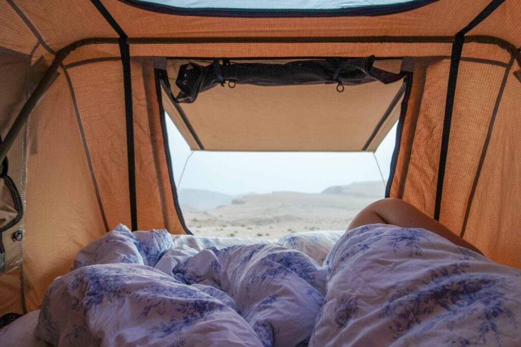
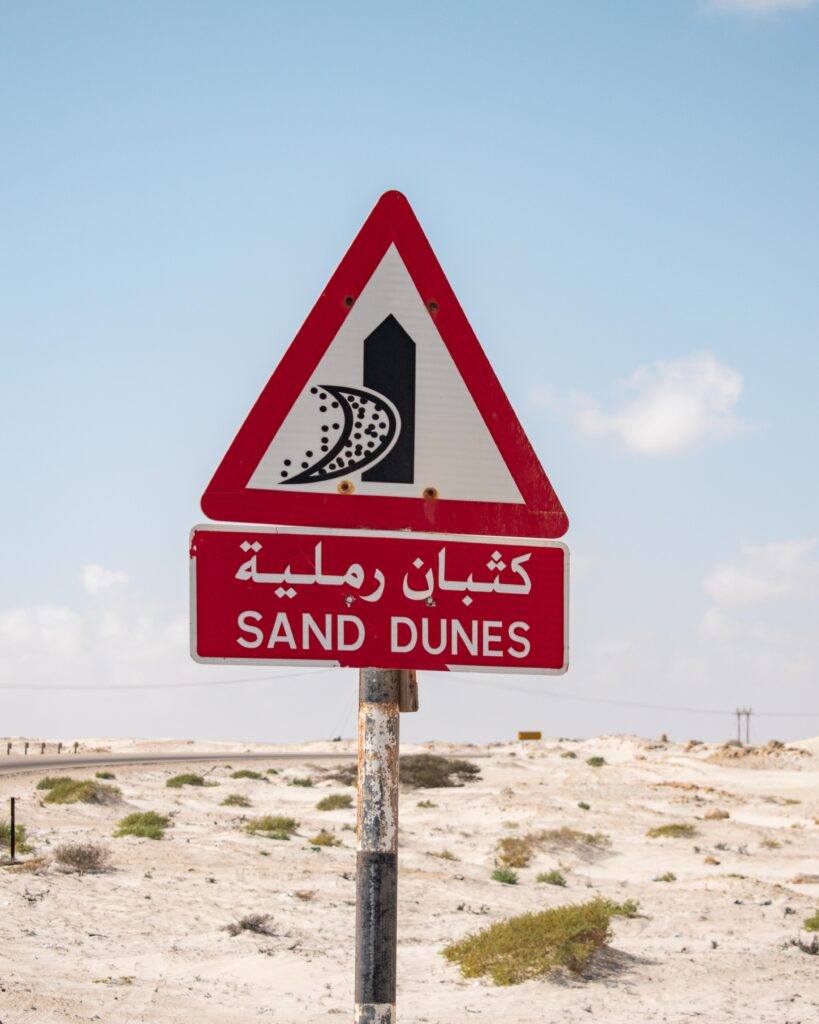
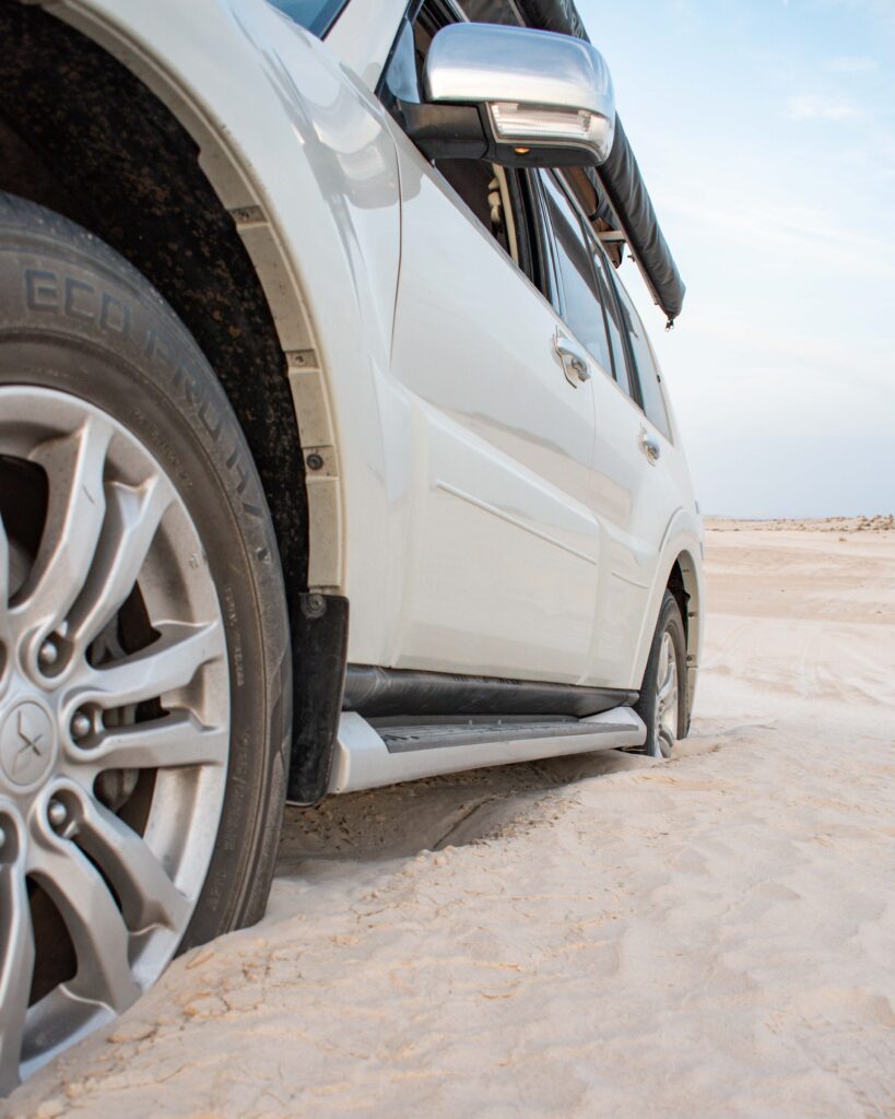
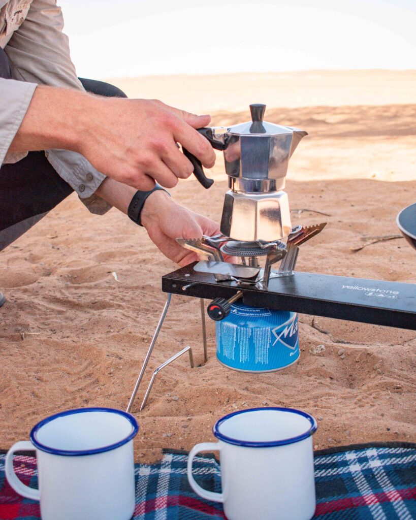
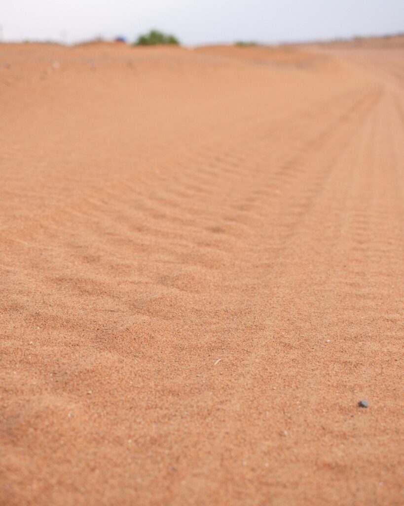
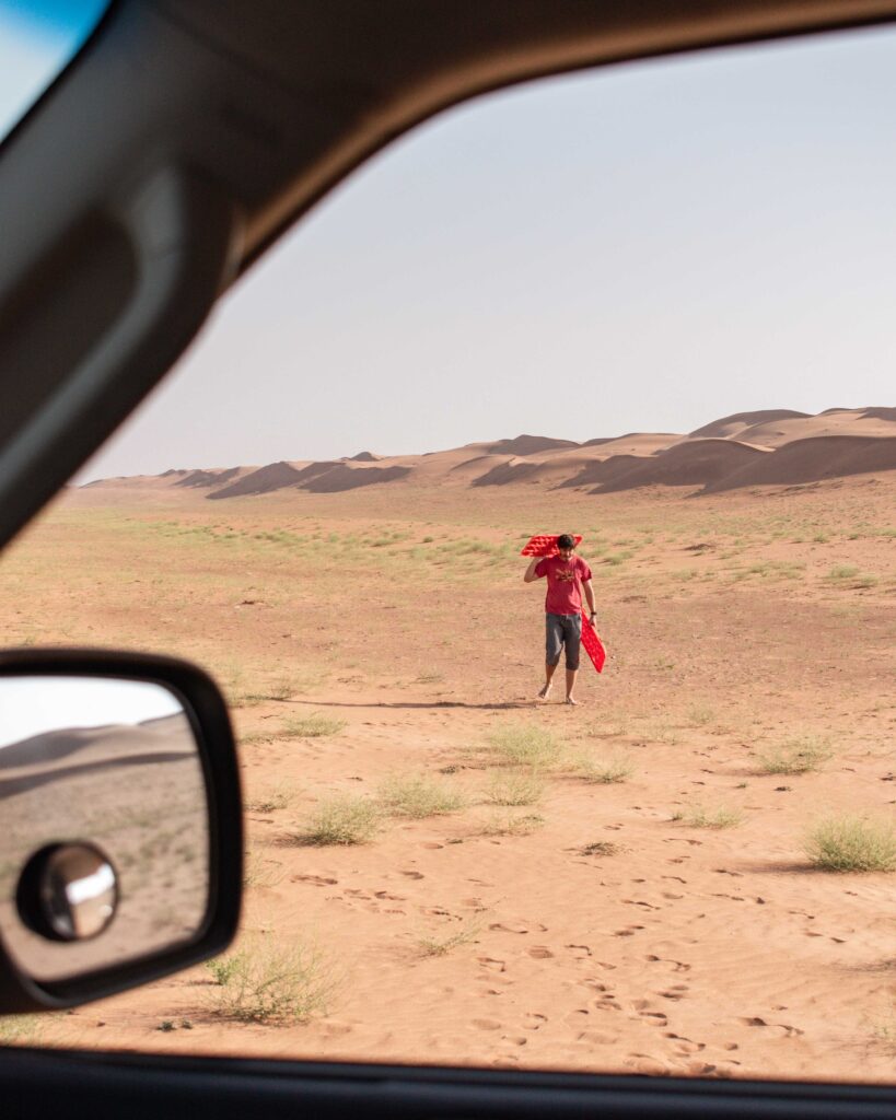
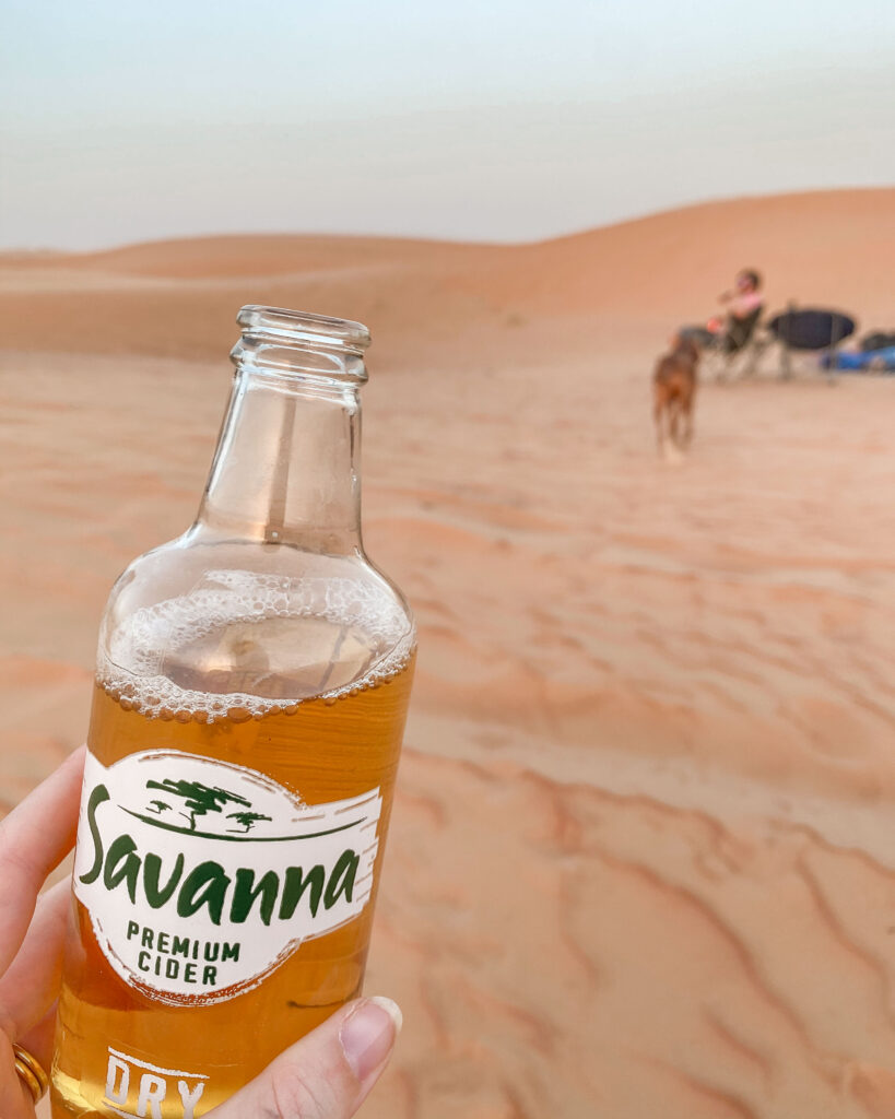
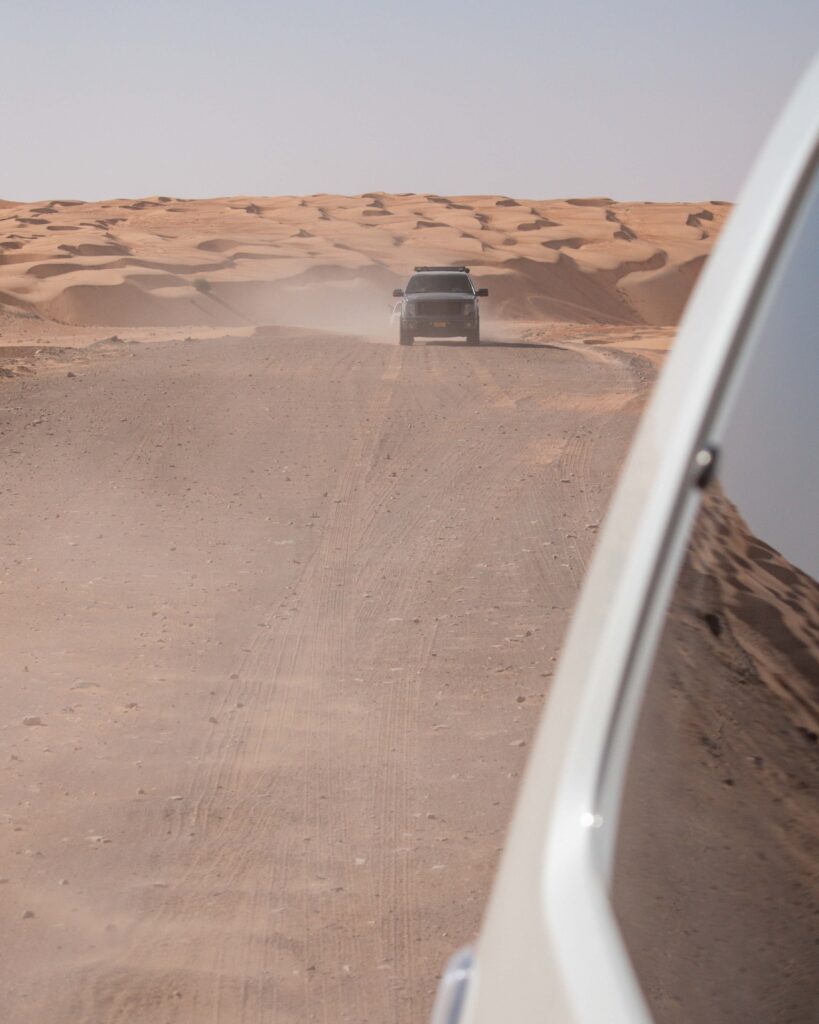
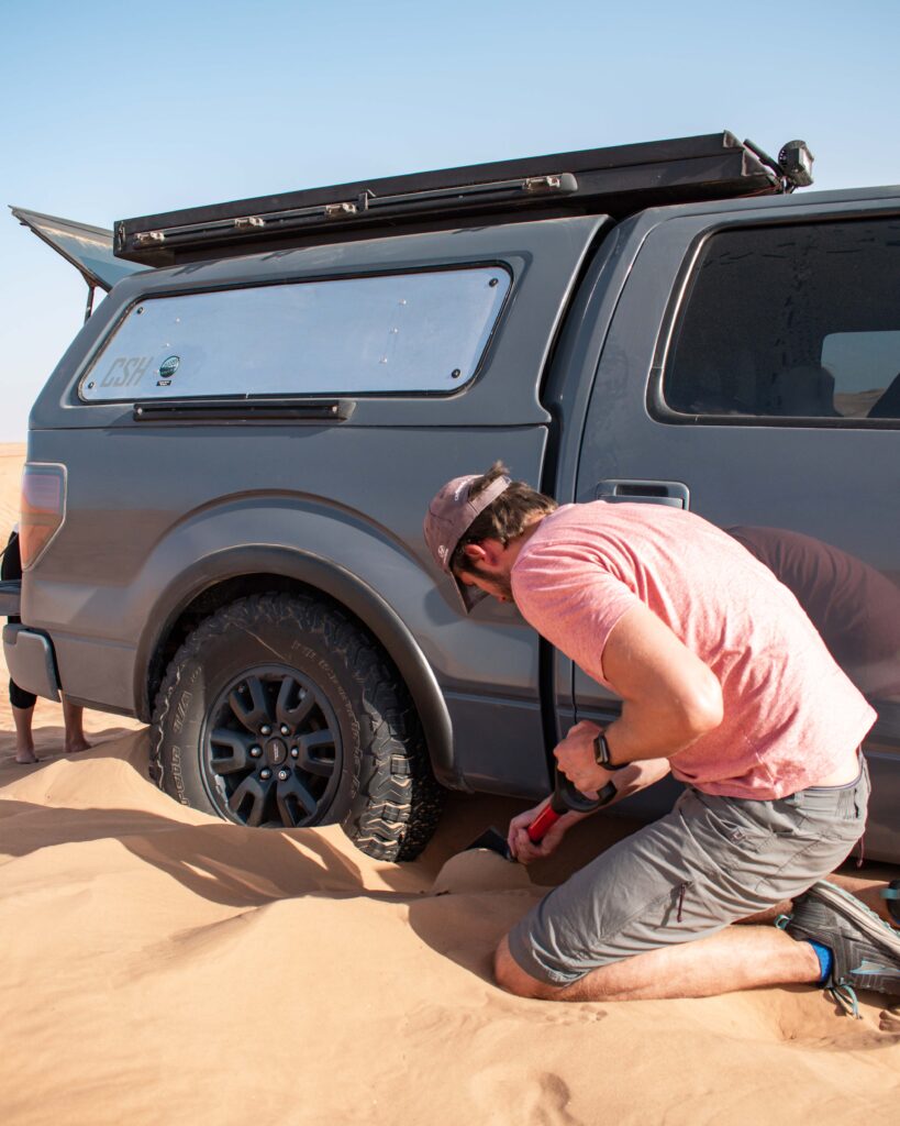
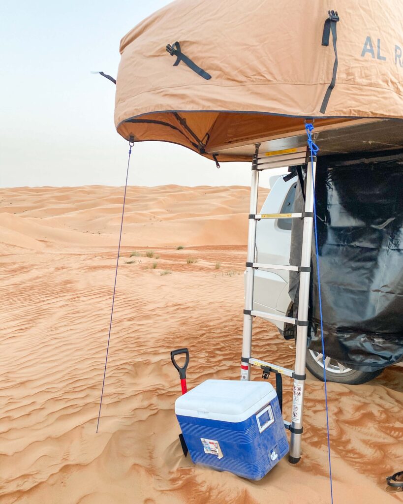
This is particularly true in the desert, where winds and weather conditions may shift the tracks around. Driving on sand is also an entirely different skill, and a desert excursion requires much more planning. Do not attempt anything you aren’t confident with, and travel in convoy where possible. Check out my guide to camping in the Omani desert for some general tips to keep you safe.
OMAN’S BEST OFF ROAD ROUTES
WADI AL ARBAEEN
Distance: 17 miles/27.5km
Difficulty: Easy
Route Map
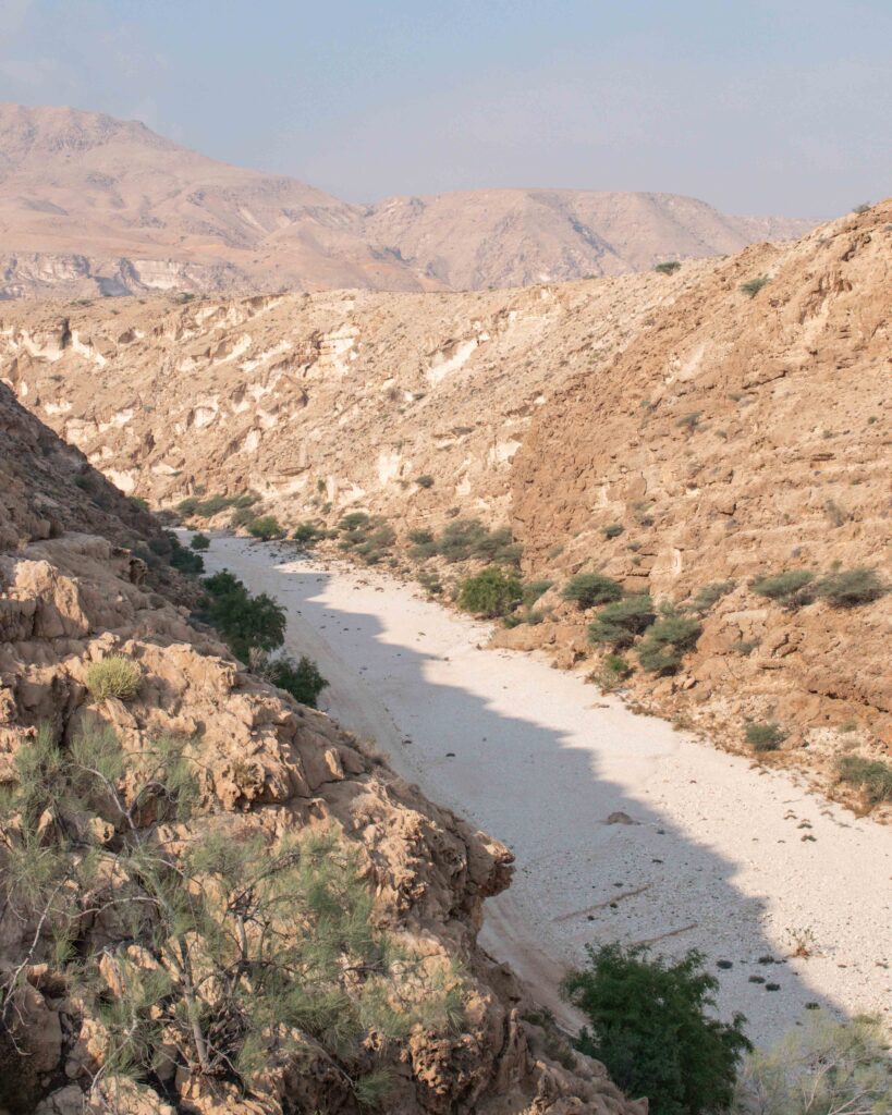
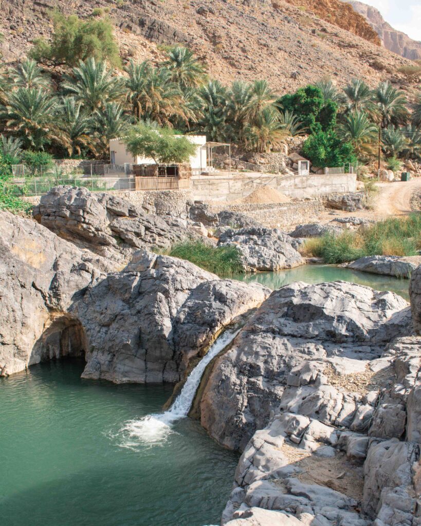
Wadi Al Arbaeen (also: Wadi Al Arbiyyin) is a popular weekend day trip for Muscat residents, but features far less frequently on visitors’ itineraries. I think this is a real shame as it is possibly my favourite wadi in Oman!
As you drive south along Highway 17 from Muscat, the turning to Wadi Arbaeen is sign posted (23.107490, 58.982245). Keep going for approximately 3 miles/5km until you hit a junction – take the left hand (signposted) route for a further 1 miles/1.5km until you hit the dirt road. Keep driving until you get to a bright red and somewhat alarming “danger” sign – take the hint and park up there. The first pool you come to is accessible for those with a limited ability to walk too far, or who are not keen on scrambling over boulders.
There are two options once you get into the wadi. You can either cross the first pool and head up to the right. A few hundred metres in you will see a traditional Omani irrigation system – the falaj – which offers an easier route to follow and walk along. Don’t walk in the water – this is still a working water source for the village. After about one and a half hours you will reach a huge waterfall and a series of pools you can swim in. There is a fair amount of scrambling over boulders to get there.
If you take the left hand route at the first pool, it will take you up to pools of clear water, that become ever more secluded the further you walk.
On your return journey, take the route back out through the wadi bed – a more significant off road undertaking than the way in described above. Retrace your route back through the village, to the turning down to the right and into the wadi bed (23.0452, 58.9761). There is then only one off road path to follow (7.5 miles/12km), to make your way back out onto the highway at Dibab. Depending on the time of year, and weather conditions, there are more pools to explore – some of which you might need to drive through to continue along the route.
If you want to camp at either end of this route, the best options are along the cliffs tops between Bimmah and Fins – just watch out for the blow holes! There are a few places of higher ground that you could camp on along the route itself, but as ever, be very careful about where you pick given the risk of flash flooding in the wadi bed. Check into the lovely Wadi Al Arbeieen Resort if you prefer hotel accommodation.
WAKAN VILLAGE
Distance: 2 miles/3.5 km off road
Difficulty: Easy
Route Map
About 90 miles/150km from Muscat, the village of Wakan sits 2,000 meters above sea level, in the Western Hajar Mountains. This small mountain village is known for its terraced gardens filled with apricot and pomegranate trees, overlooking the Jebel Akhdar mountain range above and Wadi Mistal below. Have a look at my guide to visiting during the blossom season and the hiking trails that start in the village for ideas on what to do in this pretty spot.
This route follows a relatively narrow dirt track and the views back down Wadi Mistal make it feel a bit of an adventure, but it is mostly a straightforward route. The last few hundred metres can get quite dusty and sandy in the peak tourist period in late Spring. This can be a little bit trickier if you have no off road experience as it is quite steep, but nothing too difficult.
To get to Wakan, take the turning off the Nakhal to Al Awabi road, towards Wadi Mistal (23.373801, 57.691634). The road continues to be paved for about 15 miles/25 kms, before turning into a dirt track (at approx. 23.156681, 57.747942). From here, simply follow the twisting off road, clearly marked path, for around 2 miles/3.5 km, up to the village, which can be seen from a long way out.
If you would like to camp, do so in the valley below, not the village itself. Although residents are incredibly welcoming, the village is perched on the side of a mountain and there is very little ground not covered by gardens or homes.
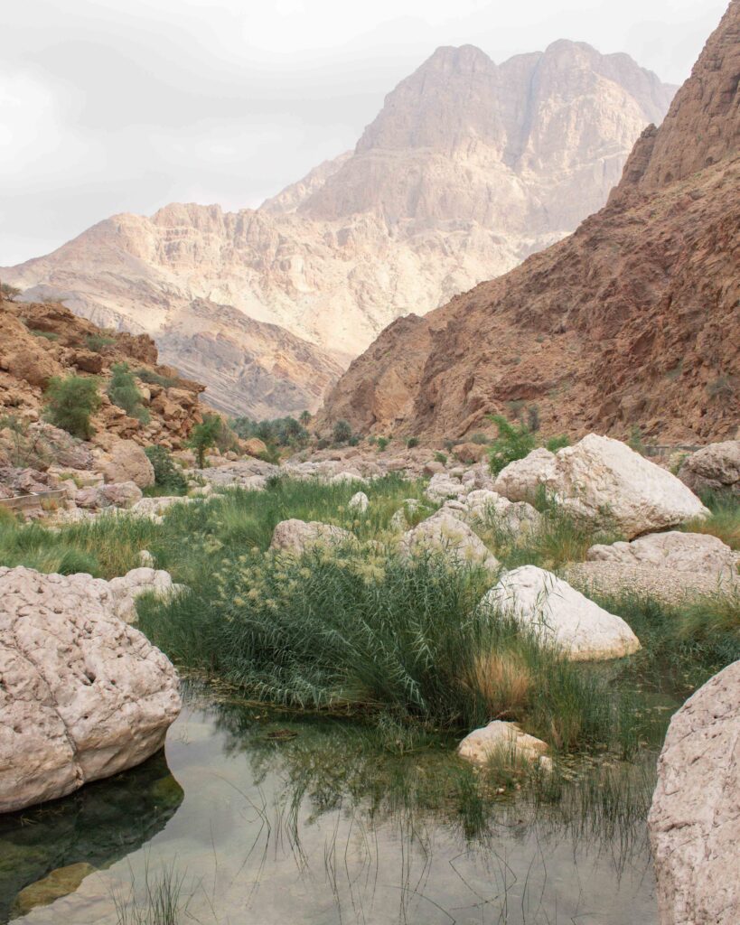
WADI DAMM TO JEBEL SHAMS
Distance: 30 miles/48 km
Difficulty: Easy
Route Map
Although not especially long, or difficult, this is a fun stretch of off road you shouldn’t miss whilst in Oman. The route is interesting enough to feel like an adventure, and the views are spectacular as Oman’s highest peak, Jebel Shams, emerges in front of you.
After exploring the turquoise pools of Wadi Damm, make your way back to the Al Hayl road, and turn left at the roundabout at 23.225640, 57.038438. After about 6 miles/10 km, turn left again at 23.162996, 57.071429 and head a further 2 miles/3.5 km to 23.166549, 57.099934. Turn right and after about 4 miles/7 km you will get to the turning onto the main road leading up Jebel Shams (23.173521, 57.149097). Turn left and continue all the way to the canyon rim, past the Jebel Shams Resort.
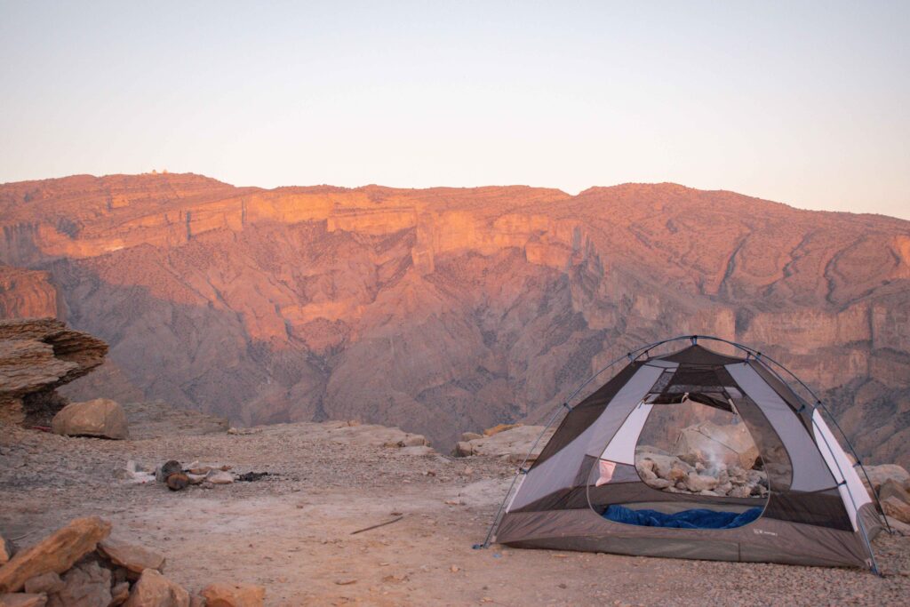
Jebel Shams offers some of the best camping in Oman. Set “Jebel Shams Viewpoint 3” into your navigator, and find somewhere along the edge of the canyon to park up for the night. There are multiple spots to choose from, all offering spectacular views into Wadi An Nakhur and across to the true summit of Jebel Shams (the highest mountain in Oman at 3000m).
SALMA PLATEAU
Distance: 31 miles/50 km (Hwy 17 to Hwy 17);
35 miles/57 km from Fins to the Ibra side
Difficulty: Challenging
Route Map
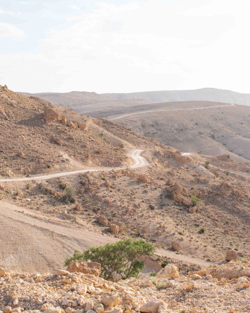
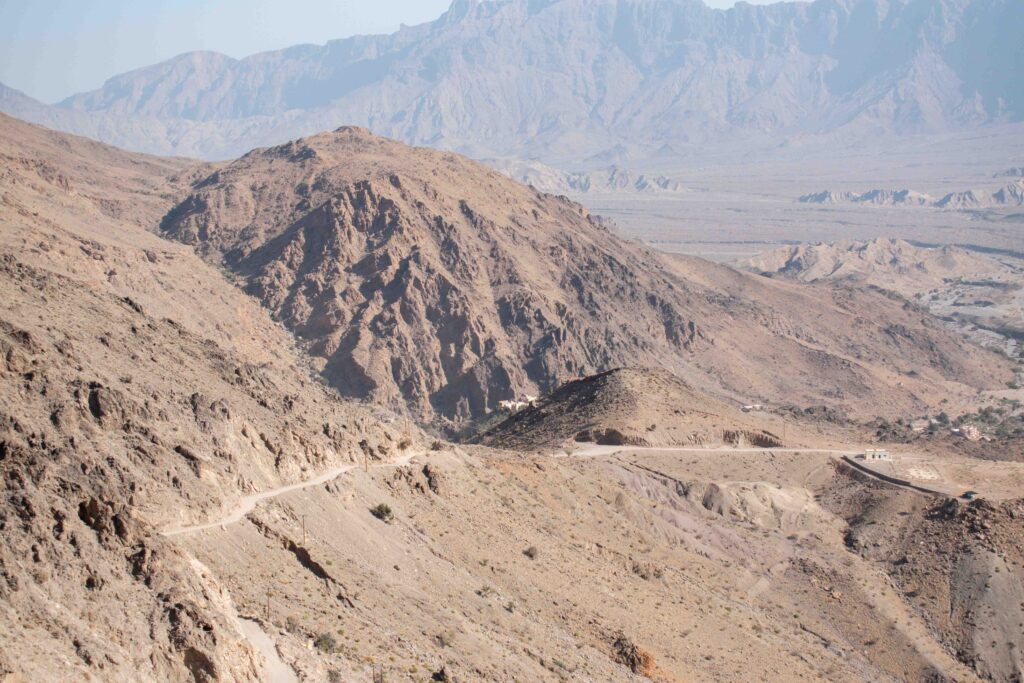
The Salma Plateau is in the Eastern Hajar mountain range. Although less dramatic than the peaks of Jebel Akhdar and Jebel Shams in the Western Hajar, it won’t take you long to realise why the Salma Plateau is one of the most popular off road routes in Oman amongst weekend enthusiasts.
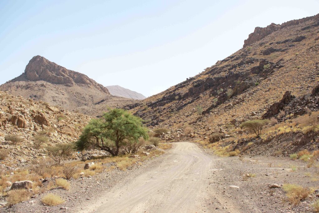
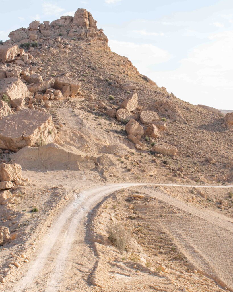
The route starts at the Fins junction on Hwy 17 (22.916242, 59.194910), but instead of heading down to the famous beaches, drive inland towards the imposing looking escarpment. This track now runs all the way to the top of the plateau, and is clearly defined and easy to follow. You will hit the first steep section after about 6 miles/10 km (22.895330, 59.144141). A series of tight hairpin bends on dirt track, wind you up the side of the mountain, but there are plenty of passing spaces as you ascend. Once you are on the top of the plateau, although the roads are all unpaved, there is nothing particularly challenging and they are mostly in good condition.
Once up onto the plateau, I recommend following the track along the top to the beehive tombs at 22.807437, 59.069683. There are a number of these mysterious tombs across the plateau, but I think these are the best situated, perched on the edge of a dramatic ridge. Little is known or understood about these tombs, but they are thought to date from around 4,000 years ago.
There are two routes back down from Salma Plateau. Either back down a partially tarmacked road towards the coast and Fins to re-join Hwy 17, or over the other side of the plateau towards the dunes of Wahiba Sands.
To return to Hwy 17 and the coastline of Fins, return to the main track from the beehive tombs and turn right at 22.830719, 59.099230, following this route for about 9 miles/14.5 km to the start of the steep tarmac descent (22.867815, 59.178108). This route then winds its way back down to the coast, via some very impressive switchbacks, to Hwy 17 about 4 miles/6 km south of where you originally left it to start your adventure (22.870860, 59.224049).
If you plan to head up and back down from Hwy 17 and Fins, it is recommended to go up the dirt track, and back down the tarmacked route as set out above. The theory is that the tarmac will allow slightly more grip for a controlled descent (although more confident locals speed down the dirt track seemingly without any concern!).
To continue over the other side of the plateau, towards Wahiba Sands, from the beehive tombs (22.807437, 59.069683) retrace your steps until you get back to the junction at 22.813631, 59.067236. Instead of turning right back towards Fins, take the left fork. You will pass more beehive tombs after about 2 miles/3 km (22.816806, 59.054389), keep going for another 4 miles/6.3 km where you will reach a small mosque (22.825950, 59.012219). Take the right hand turn, and after 2.6 miles/4.2 km the track will divide – 22.834820, 58.993991 – they re-join after 2 miles/3 km, so take whichever appeals on the day! Follow the track until you hit the paved road at 22.887849, 58.885244. Turn left to head towards Ibra, Wahiba Sands or back to Muscat on Hwy 23 (the Sharqiyah Express Way). Camp on top of the plateau for some of the best star gazing in Oman. There are no hotels on the plateau, and no facilities so stock up well before embarking on your off road trip. However, there is a fair amount of local traffic heading up and down onto the plateau at most times of the day, so if you get into trouble, it is likely someone will be around to help.
WADI BANI AWF
Distance: 40 miles/65 km
Difficulty: Challenging
Route Map
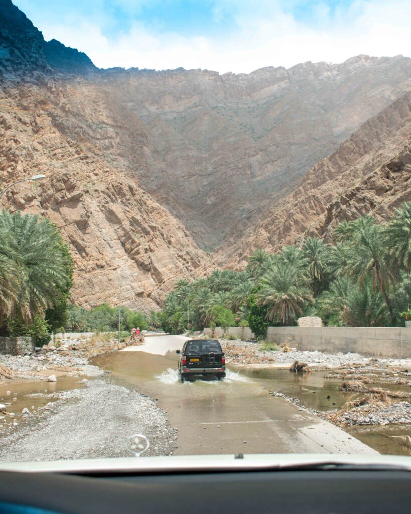
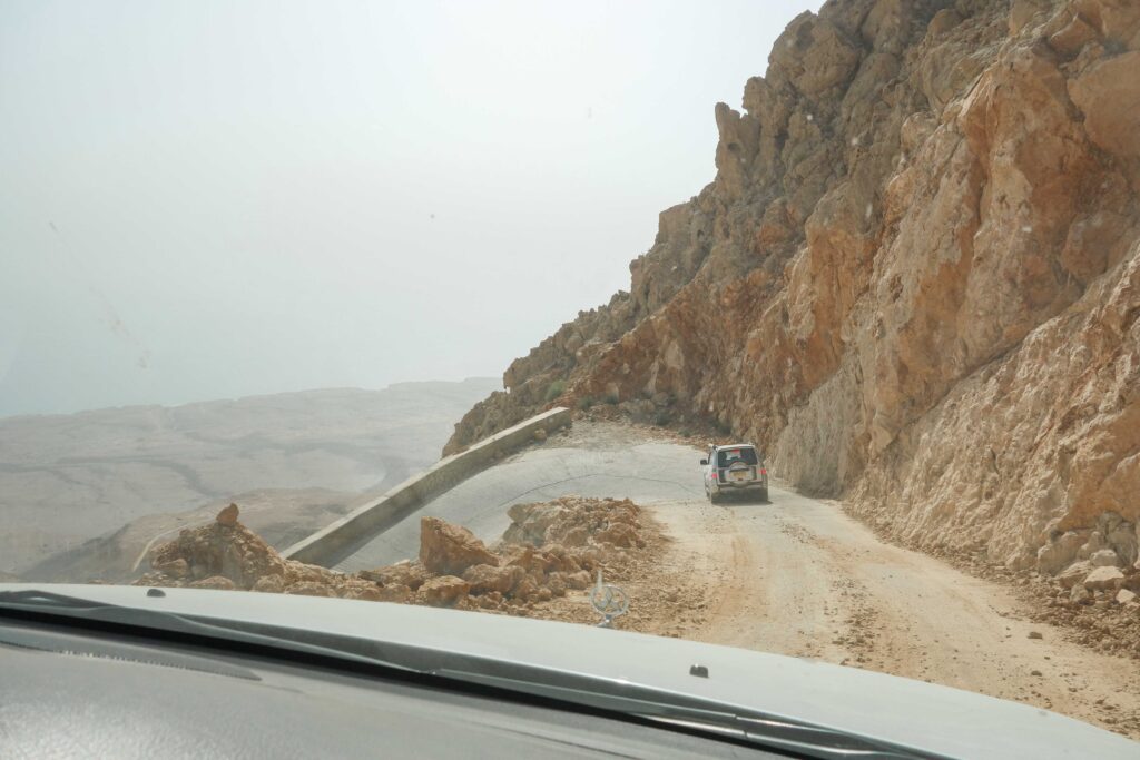
Wadi Bani Awf covers a large area, including the ever popular Snake Canyon, and offers what many consider to be Oman’s best mountain pass. The first 10km is straightforward, on a paved road, but you soon get onto ever more demanding dirt track, with panoramic views, steep climbs and some vertigo-inducing drops on some narrow hairpin bends.
The route starts by turning off the Rustaq-Nakhl road (23.342571, 57.493000). Follow the paved road until the village of Al Tikhah (23.270208, 57.448711) – after this point you are on graded road, although it doesn’t start to climb the side of the mountain range for several miles/kms. After 1 mile/1.8 km you will come to a junction with a rather impressive range of sign posts in all directions (23.257749, 57.440987). Turn left to follow the route to Al Hamra and Balad Sayt. About 1.8 miles/3 km further down the road you will pass the entrance to Little Snake Canyon on your right (23.240557, 57.437038). Keep following this route for about another 5 km until you reach the village of Al Zamah (23.216264, 57.403908).
From this point on, the route gets more serious, with steep climbs and hairpin bends a plenty. The track is narrow, often without space for two cars to pass. Ensure you have confidence that you know how to use your 4WD if you plan to tackle this section. Wiggle your way up the mountain to the turn off for Balad Sayt – an elevation gain of not far off 2,000m in a little less than 1.8 miles/3 km – looking out for the famous Snake Canyon on both sides of the road (23.212320, 57.386624). Take the left hand turn. The road continues to climb, through the village of Bimah, to reach the photogenic football pitch at Balad Sayt (23.201592, 57.391677). Obviously the route can be done in either direction!
Continue onwards to pass through the villages of Hatt and Al Hajar. The road gets steeper and steeper until you reach Sharaf Al Alamein – the highest point of the route at about 2,000m (23.167241, 57.415388). This is also where the unpaved road meets the tarmac road which winds up the other side of the mountain. It is about a further 18.6 miles/30 km back down the mountain to Al Hamra, on steep, but paved, road.
If splitting your journey over two days, I recommend spending the night at the top of the pass near the villages of Bimah or Sharaf Al Alamein for the best views. But choose your camp spot carefully – the risk of flash flooding here is very real. Sadly, a number of people have been killed in recent years after getting caught in adverse weather. There are a number of good areas to camp, set back off the road in a small, tree shaded valley, very close to the start of Snake Canyon. Try out the nearby Bait Bimah for simple guesthouse accommodation.
SUGAR DUNES/AL KHALUF
Distance: 42 miles/67 km
Difficulty: Challenging
Route Map
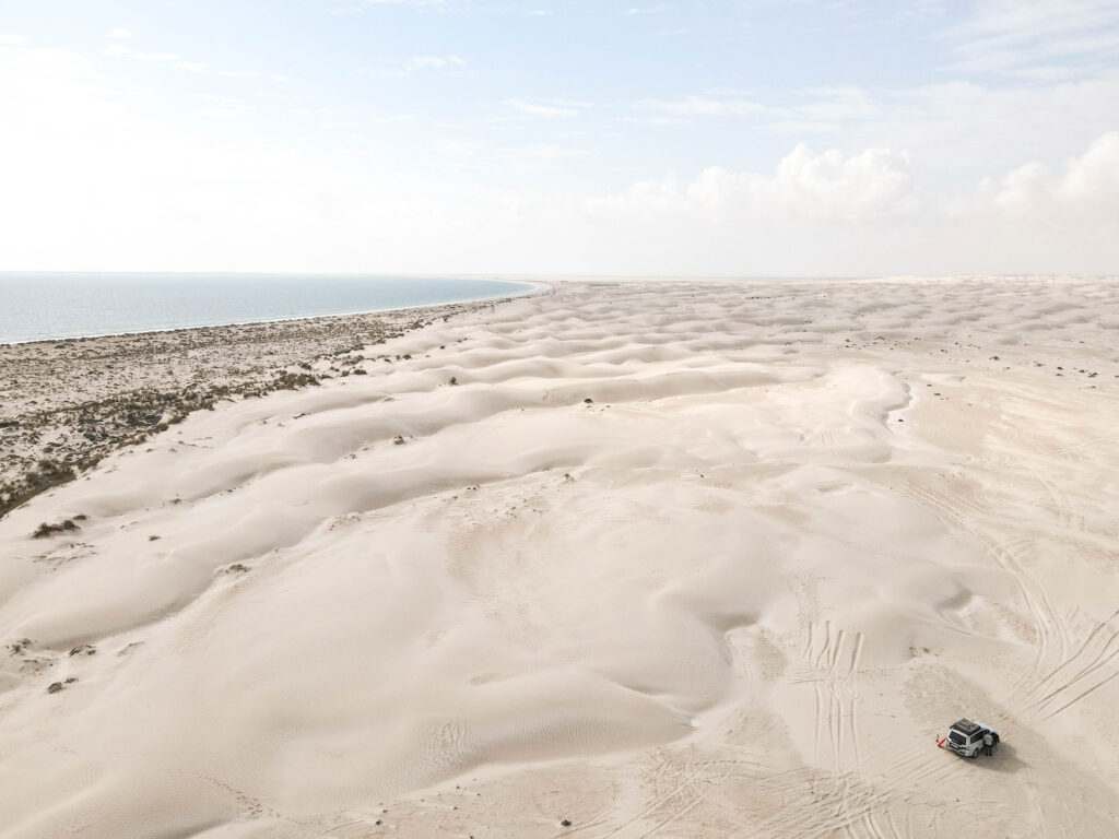
The Sugar Dunes are about a five hour drive from Muscat (approx. 400 km), so best attempted as a multi-day trip, or as part of a longer itinerary (perhaps to Sur and Ras Al Jinz, or down the length of the Omani coast to Salalah). For a really spectacular desert camping expedition, you could combine a crossing of the Wahiba with a visit to the Sugar Dunes.
From Muscat, I recommend heading down Highway 32, parallel to the dunes before turning onto the road that leads down towards the beach (20.344188, 57.782989). As the sand here is so soft, and less visited, tracks change regularly so be sure you have a GPS navigator to plot a course from this track onto the much better defined route that runs along the beach (southern coordinates: 20.375412, 57.940955). Driving north along this route there are a number of places to turn off into the dunes proper to set up camp for the night.
When leaving the Sugar Dunes, continue driving north along the well defined beach route until you curve around behind a rockier outcrop (20.433156, 57.993669) and find yourself actually on the sands of Al Khaluf beach. This 15km beach drive is one of my favourite off road stretches in Oman (although sadly the amount of plastic waste is growing exponentially). The route back into the small fishing village of Al Khaluf is easy to follow, and starts to curve back inland just after Humrat/AL Khaluf Caves (20.456114, 58.047574). You can stop to visit the cave – park in the strange, walled enclosure and the entrance to the cave is on the right as you face the sea.
If you are not confident driving on soft sand, it is possible to camp just off the beach track and the base of the start of the dunes. However, given the amount of litter on the beach I strongly recommend camping in the dunes themselves if possible. It can often also be quite popular along the beach, but you will nearly always have the dunes to yourself. Given the dunes by the beach are only a couple of metres high, you could always park up by the beach and clamber up with your tent into the dunes.
There is a small petrol station in the fishing village of Al Khaluf, and regular larger stations along Highway 32.
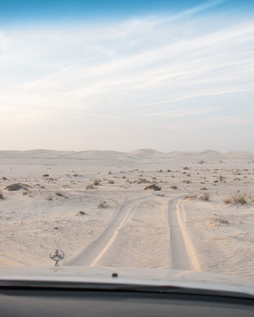
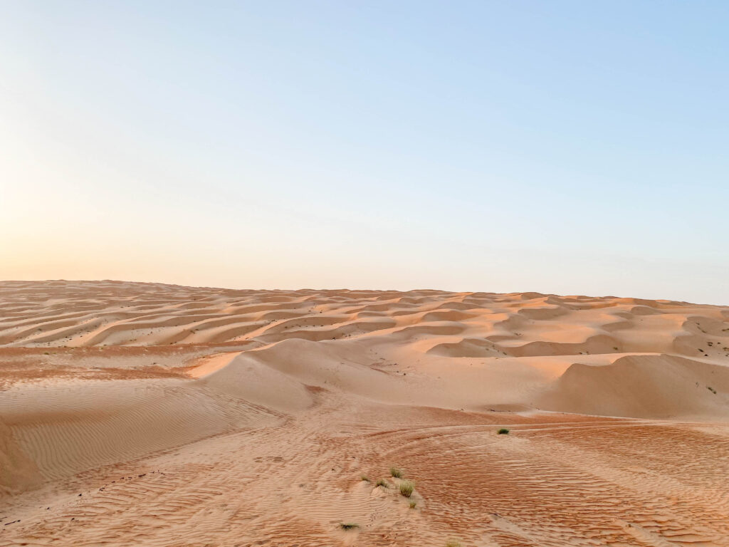
WAHIBA SANDS CROSSING
Distance: approx. 62 miles/100 km
Difficulty: Extreme
Route Map
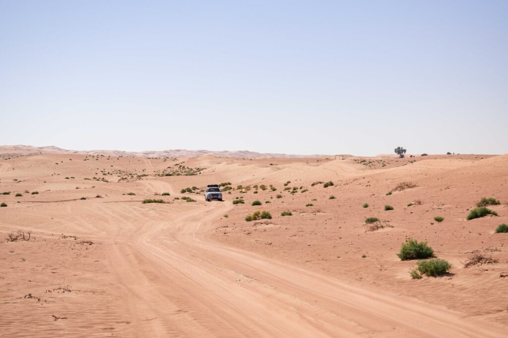
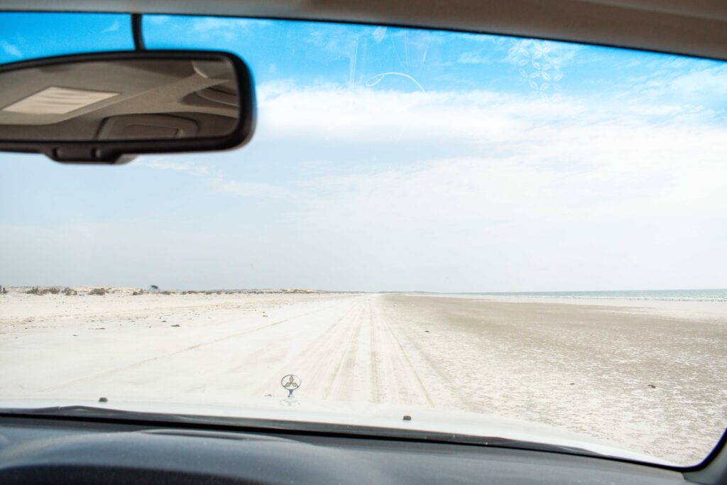
The north-south crossing of Wahiba Sands takes two days, with a night camping in the dunes in the middle. The first part, in the north, runs between towering sand dunes on either side, before giving way to wide dune plateaus towards the south, and eventually the white sands of the coastal road. Driving conditions vary along the way, with finer, softer sands usually making the southern end of the route more challenging than the northern half.
Following the route of the Wahiba Crossing, requires navigating between GPS coordinates. These waypoints are available in the route map linked above. Driving from north to south, you enter the desert just south of Bidiyah at 22.408200, 58.784500, and emerge on the eastern coast of Oman at 21.158400, 58.940300.
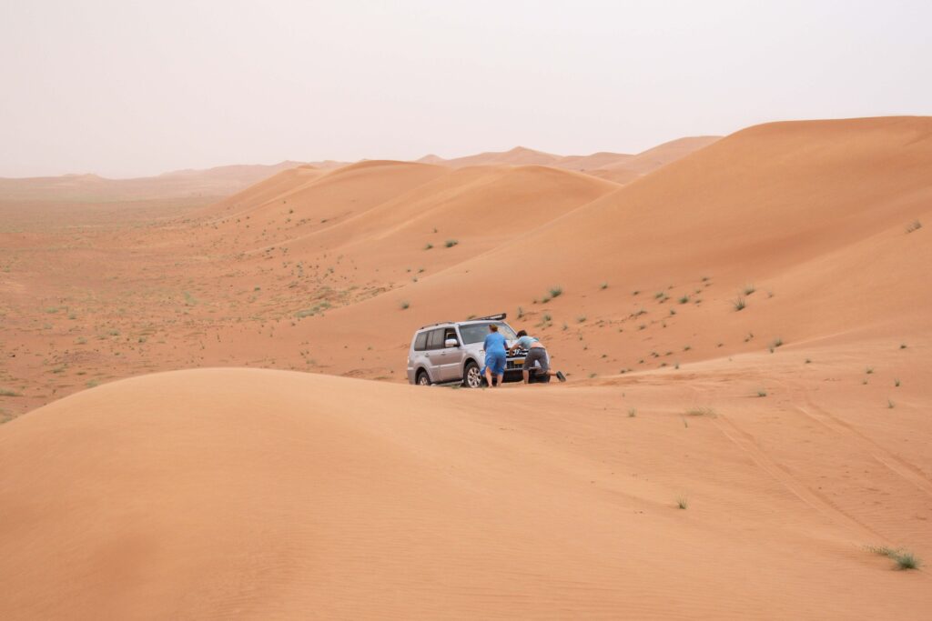
Although the route itself is relatively straightforward, the Wahiba Crossing is rightly rated “extreme” due to the isolation, extreme heat and requirement for sand driving and desert navigation. As ever in the desert, weather conditions, and especially wind, can shift the tracks around. A crossing of Wahiba Sands should only be attempted with more than one vehicle, the right equipment and off road know how.
Check out my guide to camping in the Omani desert for some general top tips to keep you safe – and a suggested packing list. And a few tips specific to this route… Only attempt this in the winter months. Even then, come prepared for very high day time temperatures (although it will be cold at night), with shade almost non-existent. Make sure you have downloaded the route, and the GPS way markers, in advance. Unsurprisingly there are no road signs in the desert, and tracks regularly split off in all directions. Finally, the return drive back along the coast is long. So either set of early on day one, to ensure you can split the drive between two days, or add a Wahiba Crossing into a wider itinerary and don’t attempt the drive back to Muscat in one go.
If you are only on a short trip to Oman, and don’t have the chance to attempt the full crossing, I recommend heading down the first track into the dunes, on the western side of the dunes. A tarmac road takes you right up to the edge of the desert, and the first mile or so of sand track is usually well compacted, making for easier driving if you are not experienced on the sand. You can camp off to either side of this track, metres from the bottom of the dunes without needing to do any extreme off roading.
EMPTY QUARTER/RUB AL KHALI
Distance: Varies! Getting there also requires a very long, isolated drive.
Difficulty: Extremely Extreme!
Most famously known in English as the Empty Quarter. Crossing the borders of Saudi Arabia, Oman, the UAE, and Yemen, the vast Rub Al Khali covers an astonishing one million square miles. That’s forty thousand square miles larger than France… although I am not clear why so many guidebooks have chosen to use France as the benchmark for desert sizes! It is the largest area of continuous sand in the world.
The Rub Al Khali offers the most serious off road routes in Oman. Partly due to the soft, and ever changing, sands, but also as it is extremely remote, and a long way from any kind of assistance. Do not underestimate the environment you are heading into – daily temperatures hover between 47 °C (117 °F) and 51 °C (124 °F) and yearly rainfall is less than 3 cm (1.2″). Whilst this all makes for an amazing wilderness trip, this is definitely one only to attempt on an organised tour or with a convoy of vehicles with experienced off road drivers. Therefore, I am not going to offer specific off road routes – this really is a destination you need to plan for independently, depending on the level of experiences in your group and the expected weather conditions. But no list of the best off road routes in Oman could leave off the Empty Quarter!
Even just getting there is an undertaking. Visiting the Empty Quarter from Muscat requires a very long drive, most of the length of the Sultanate. If time is tighter, fly into Salalah airport. There are daily flights to and from Muscat. From Salalah, getting to the dunes requires a drive northwards for about three hours (250km) on increasingly bumpy, corrugated roads. Petrol stations get fewer and further between, with the closest to the dunes close to the ruins of Ubar. However, the fuel supply is not always reliable, so do not rely on it for your first/last refuel. There are several larger petrol stations at Thumrait.
There are lots more guides to explore on Oman – and other outdoors adventure ideas – across the website, but if you have a specific question let me know in the comments below and I am more than happy to help!

Hi there. I took opportunity of your excellent informations during my recent self-drive trip in Oman. We are not so experienced in 4×4 driving, so we drived just some of the tracks you suggested. All was perfectly in line with your indications, helping us to plan everything and manage each situation. I’m not used to give feedbacks but in this case, given the huge help we gained from your dispatches, I would to thank you sincerely